1980's Pull Down Classroom Map - The Transplanting of Europe
$145.00
Check out this sweet vintage world history wall map detailing the The Transplanting of Europe in around 1700. Printed by Rand McNally this wonderful map is printed a heavy "markable" paper material. Map comes with the original cream colored metal bracket which still works and is very easy to mount. Chart still rolls up and down fluidly and its original metal rod is attached to the bottom of the map. Attached to the rod is a metal pull hook. This map would look great hanging in your library or study or would serve as a great educational work of art in your child's bedroom!
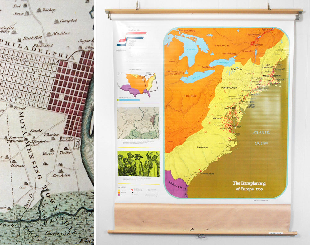
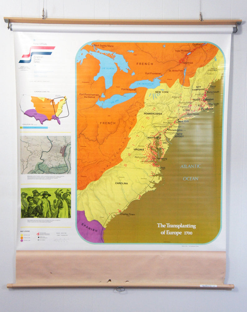
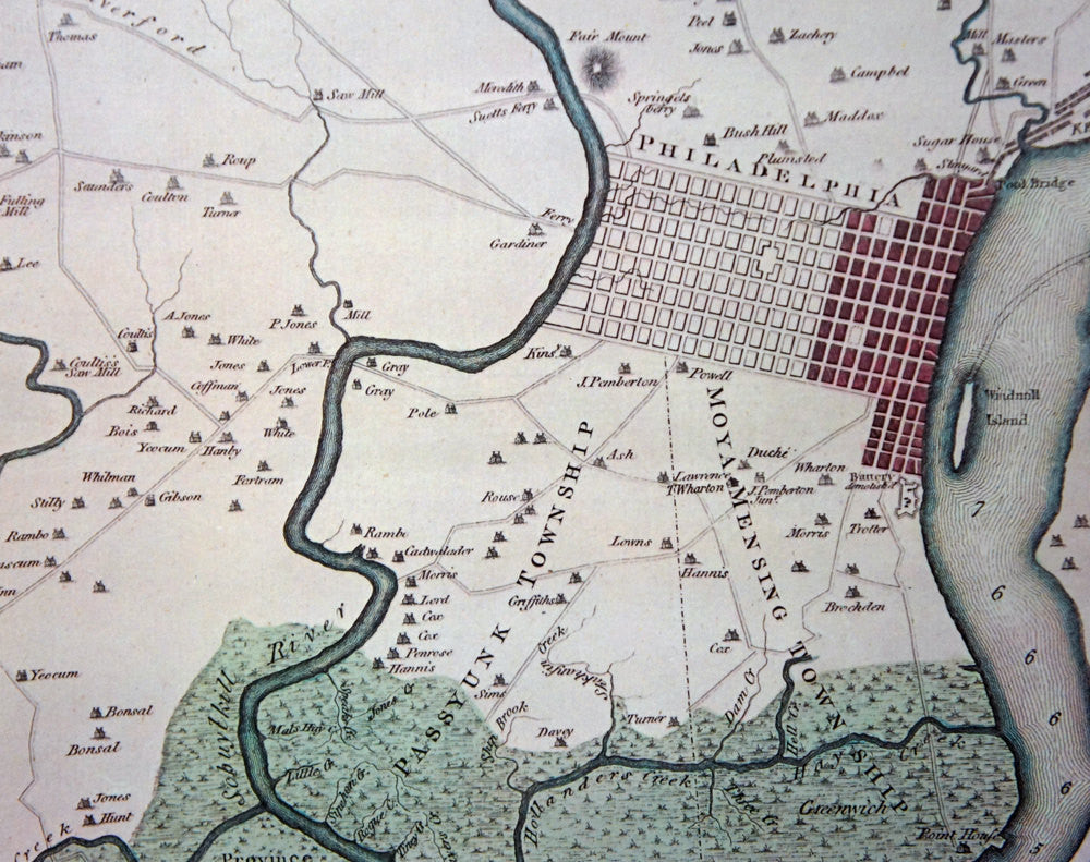
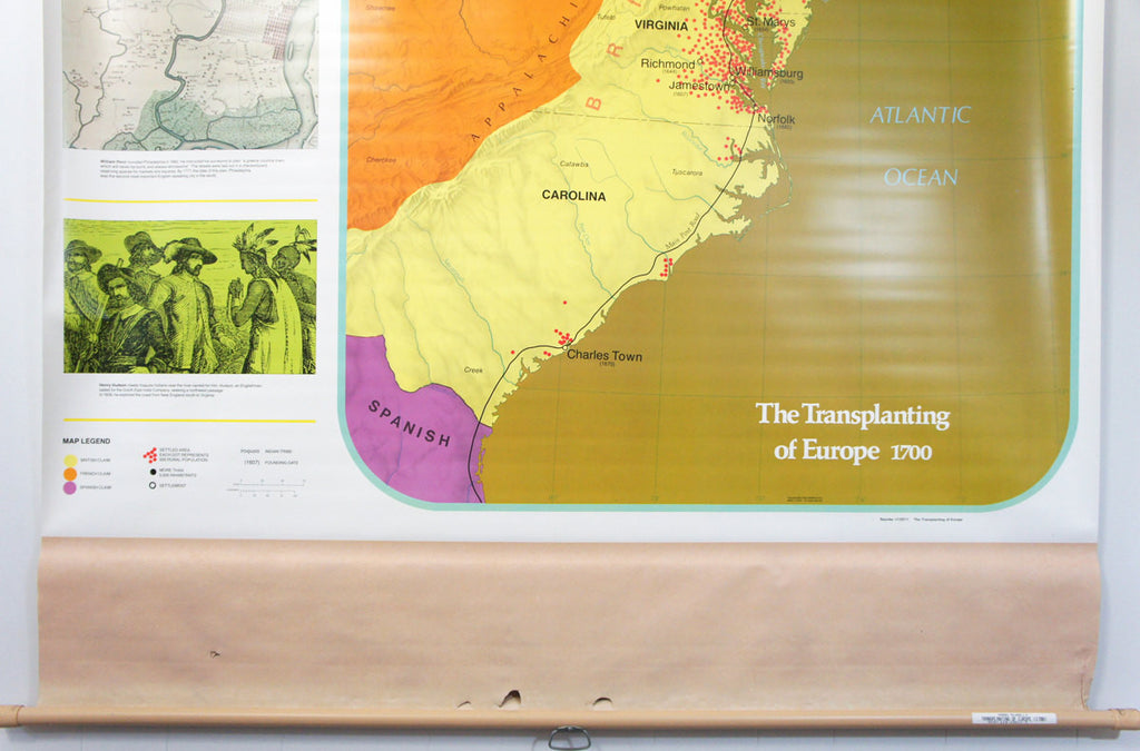
The large map details the settled areas in the Northeastern United States in around 1700. The yellow areas indicate British land, the orange indicates French land, and the purple indicates Spanish land. To the left of the large map are three smaller images. The first is a small map of the United States showing the division of land amongst the British, Spanish, and French across the country. The second image is a map detailing the Philadelphia area at around 1682, when William Penn founded the city. The third image is an illustration of Henry Hudson meeting Iroquois Indians near what is now the Hudson River.
Geography & history are awesome.
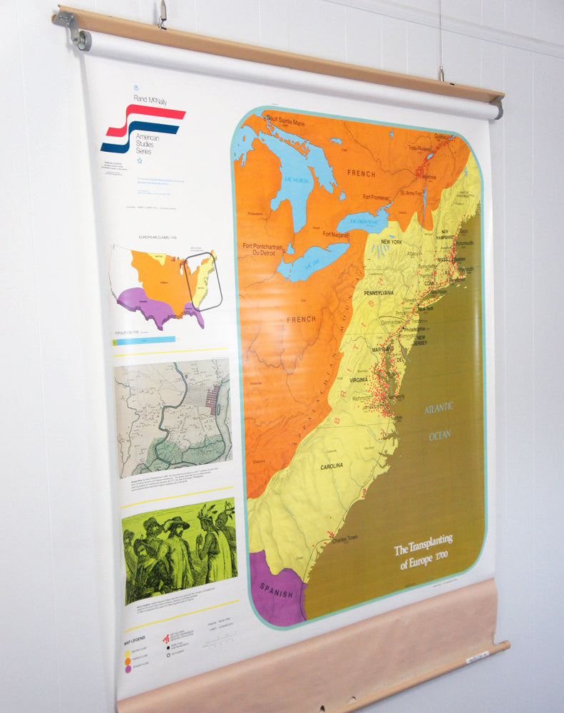
Measurements (with bracket and wooden rod): Approximately 61” long x 53.5" wide
Copyright Date: Circa 1980's
Item Condition: Great vintage condition! Has some minor wear due to years of use (i.e. a few minor wrinkles, creases, etc). Colors are still wonderfully bold and vivid! The cream colored canvas above the lower metal rod has four smal tears, three of which are above the metal pull hook. Because of this, you'll want to be careful when pulling down the map. Please refer to the pictures for further details!
The large map details the settled areas in the Northeastern United States in around 1700. The yellow areas indicate British land, the orange indicates French land, and the purple indicates Spanish land. To the left of the large map are three smaller images. The first is a small map of the United States showing the division of land amongst the British, Spanish, and French across the country. The second image is a map detailing the Philadelphia area at around 1682, when William Penn founded the city. The third image is an illustration of Henry Hudson meeting Iroquois Indians near what is now the Hudson River.
Geography & history are awesome.
Measurements (with bracket and wooden rod): Approximately 61” long x 53.5" wide
Copyright Date: Circa 1980's
Item Condition: Great vintage condition! Has some minor wear due to years of use (i.e. a few minor wrinkles, creases, etc). Colors are still wonderfully bold and vivid! The cream colored canvas above the lower metal rod has four smal tears, three of which are above the metal pull hook. Because of this, you'll want to be careful when pulling down the map. Please refer to the pictures for further details!